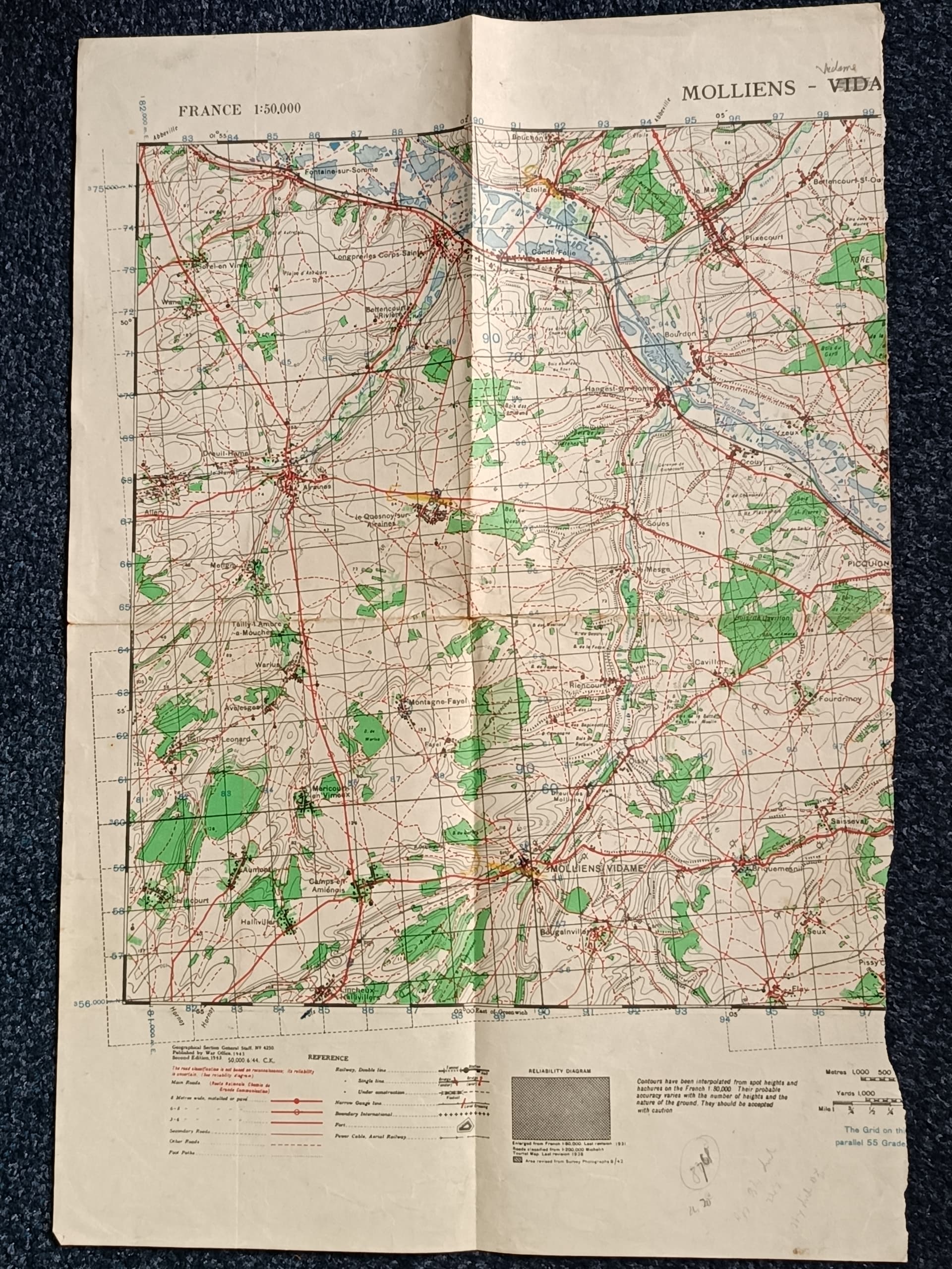
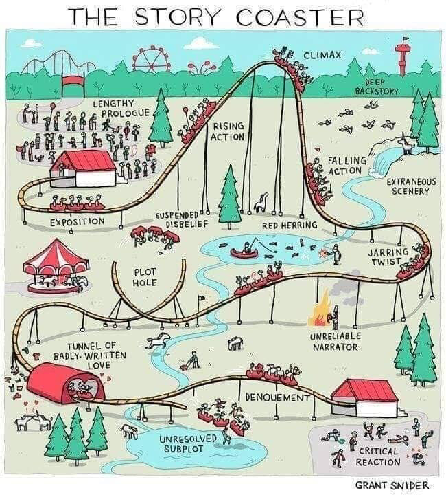
Half a WW2 Map.
Quite often these map have arrows, drawn by the user, indicating where they entered an left the area shown on map. Plus circles indicating junctions they passed through.
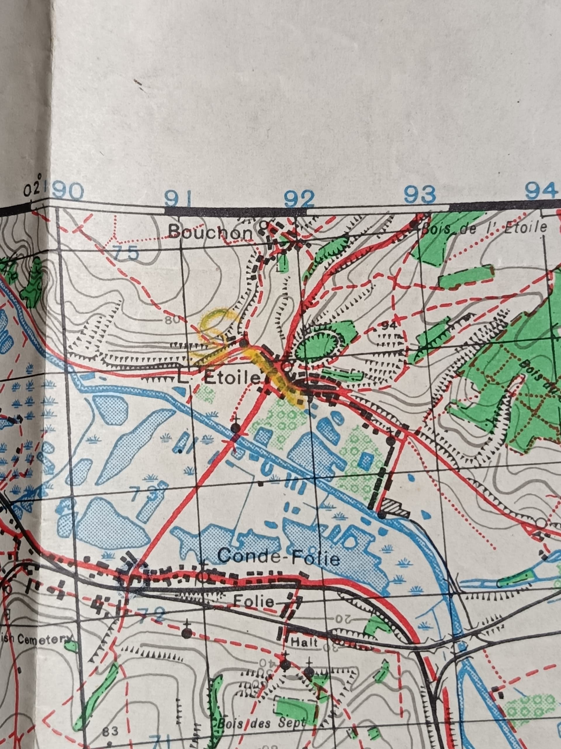
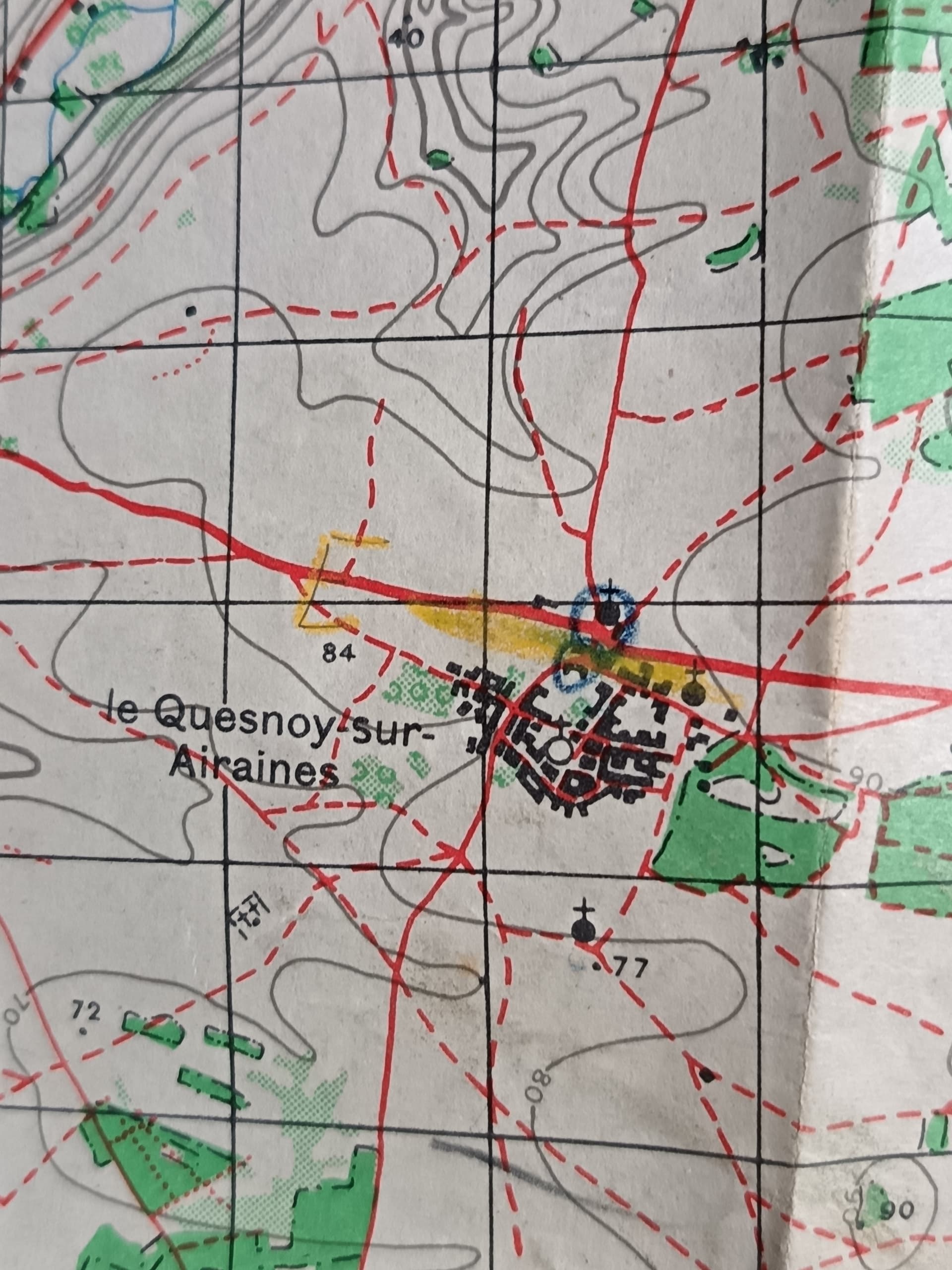
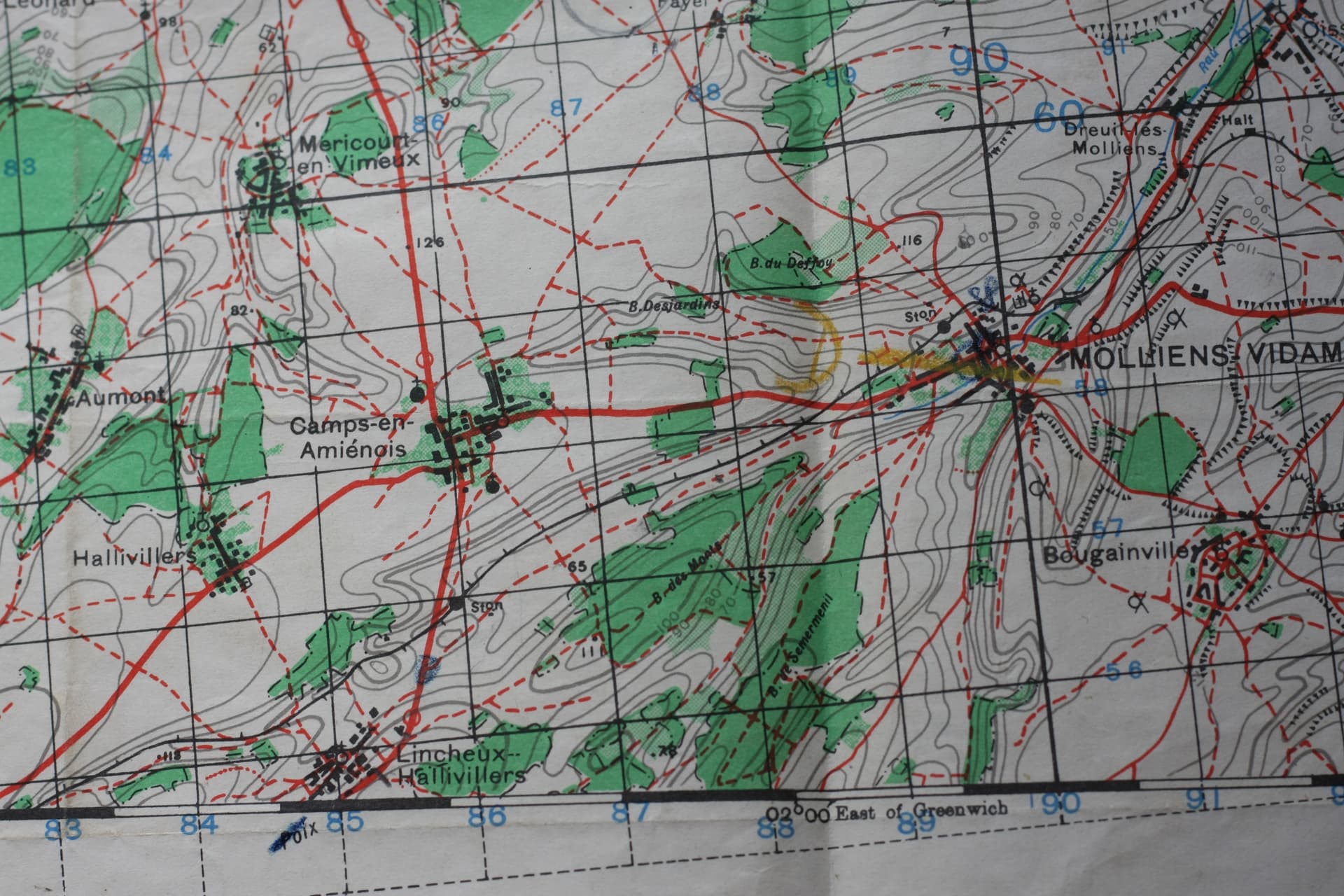
This map has three letters C, D, E and lines written in yellow crayon.
Anyone know what they signify?
Also, two notes, indicating Battery Died.

Very interesting to me. Looks like an area west of Amiens which if WWII vintage might be earlier in the war around the time of Dunkirk. Letters could indicate company dispositions I suppose but that’s all guesswork. Would love to know details if you find out more.
There’s a date on the bottom left of the first picture of (I think) 1943.
You are right published 1943. Potentially the markings and notes relate to just after the Normandy campaign but the Germans were in full retreat after that so this map could relate to anything not just action. Potentially billets or repairs etc. I’d love to know ![]()
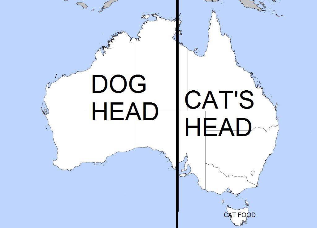
The “cat food” looks more like coughed up fur ball.

Paul
I took a closer look at the map, and there is information that I hadn’t noticed.
There is a line drawn in blue pencil indicating were the user entered the map, and circles drawn in blue pencil indicating junctions that the user passed through. I’ve seen these marks on other maps but a black pencil used.
It appears minor roads are used, with major roads are avoided,
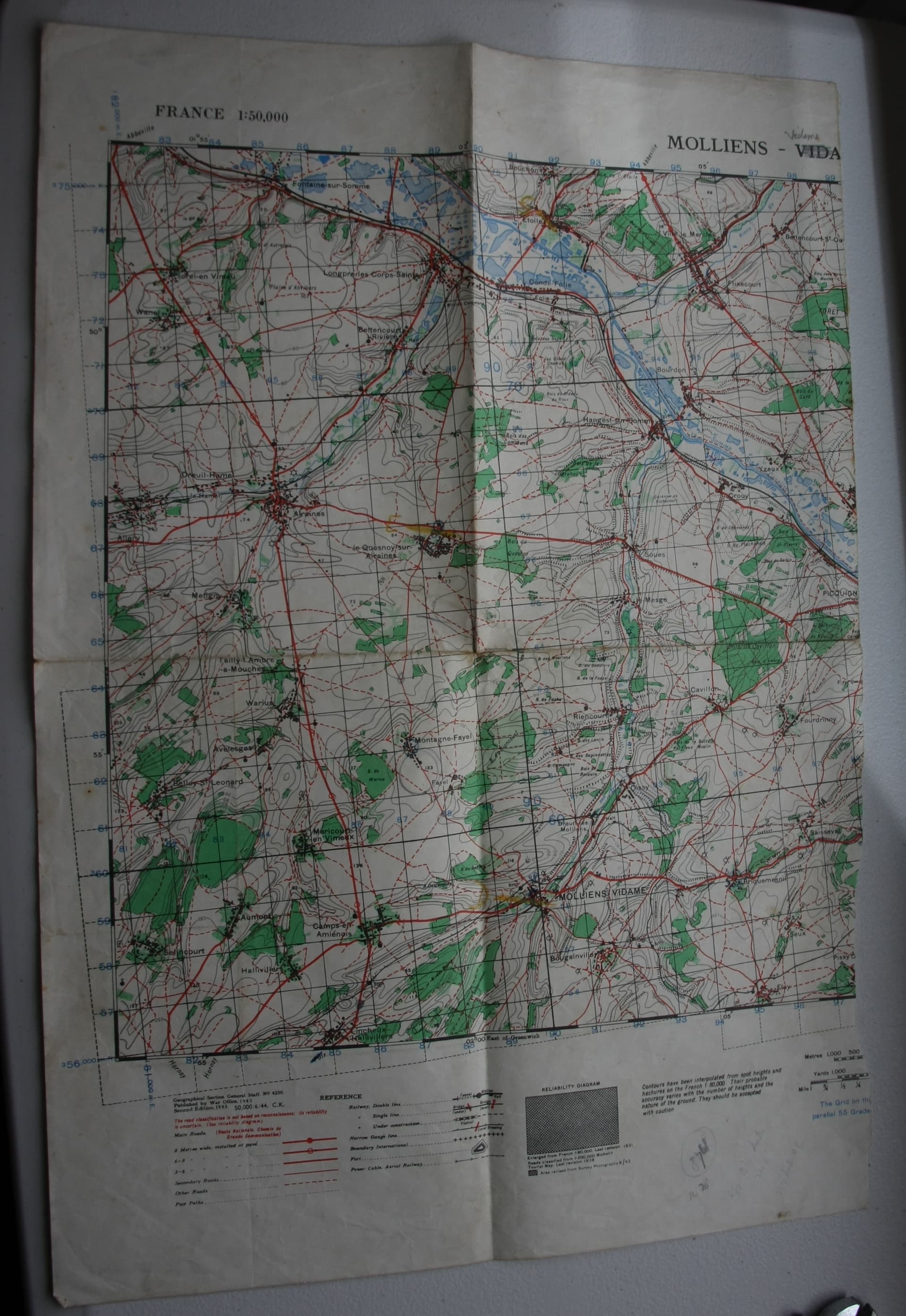
Enters the map to the left of 85 (Blue pencil line). Travels a short distance north turns right (at the blue spot) onto what is designated as an “other road”

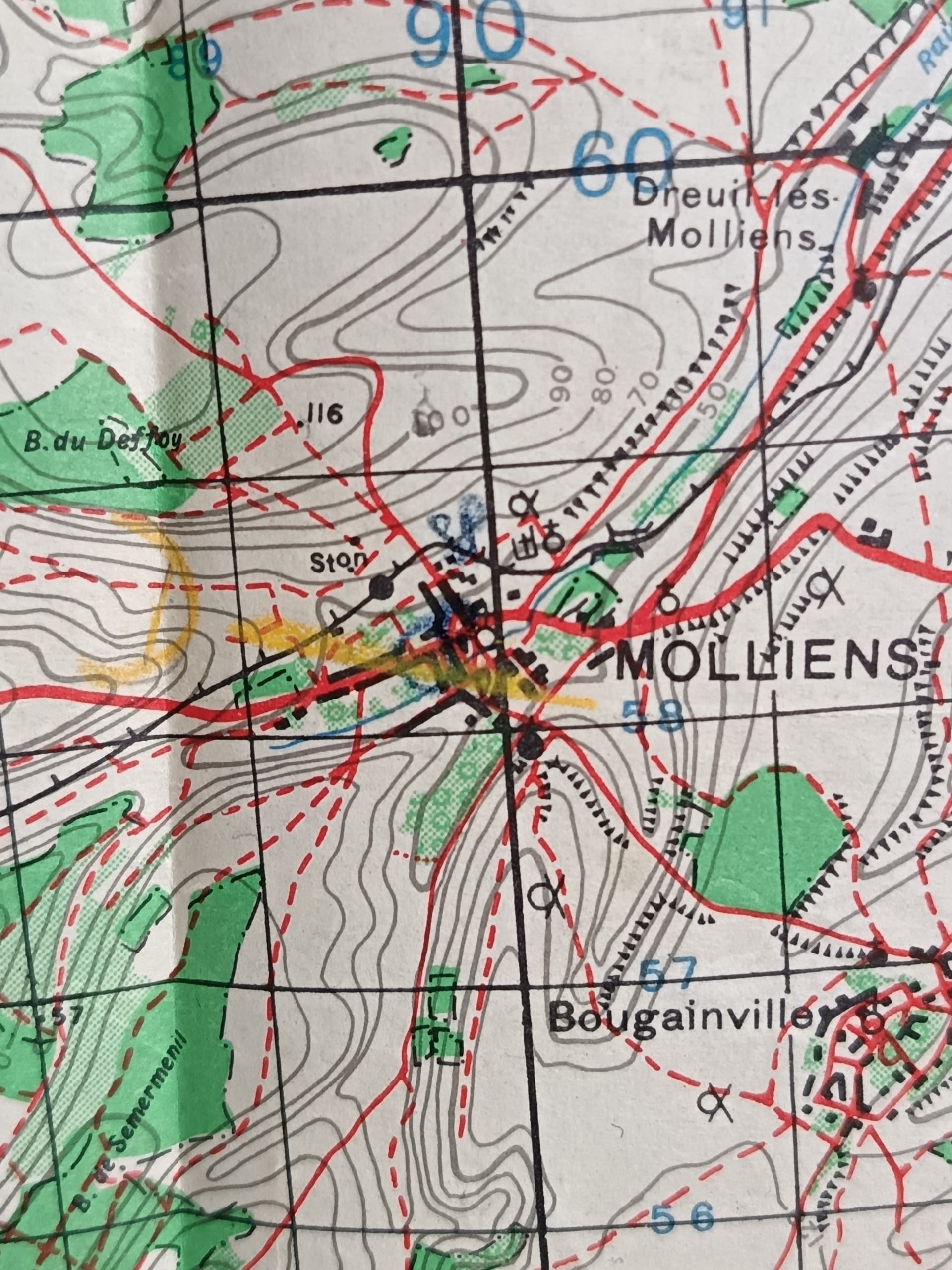
Travels east to Molliens Vidame
Travels north from Molliens Vidame to Montagne Fayal

Travels north from Montagne Fayal for a short distance to junction (blue circle)

Travels north to le Quesnoy.
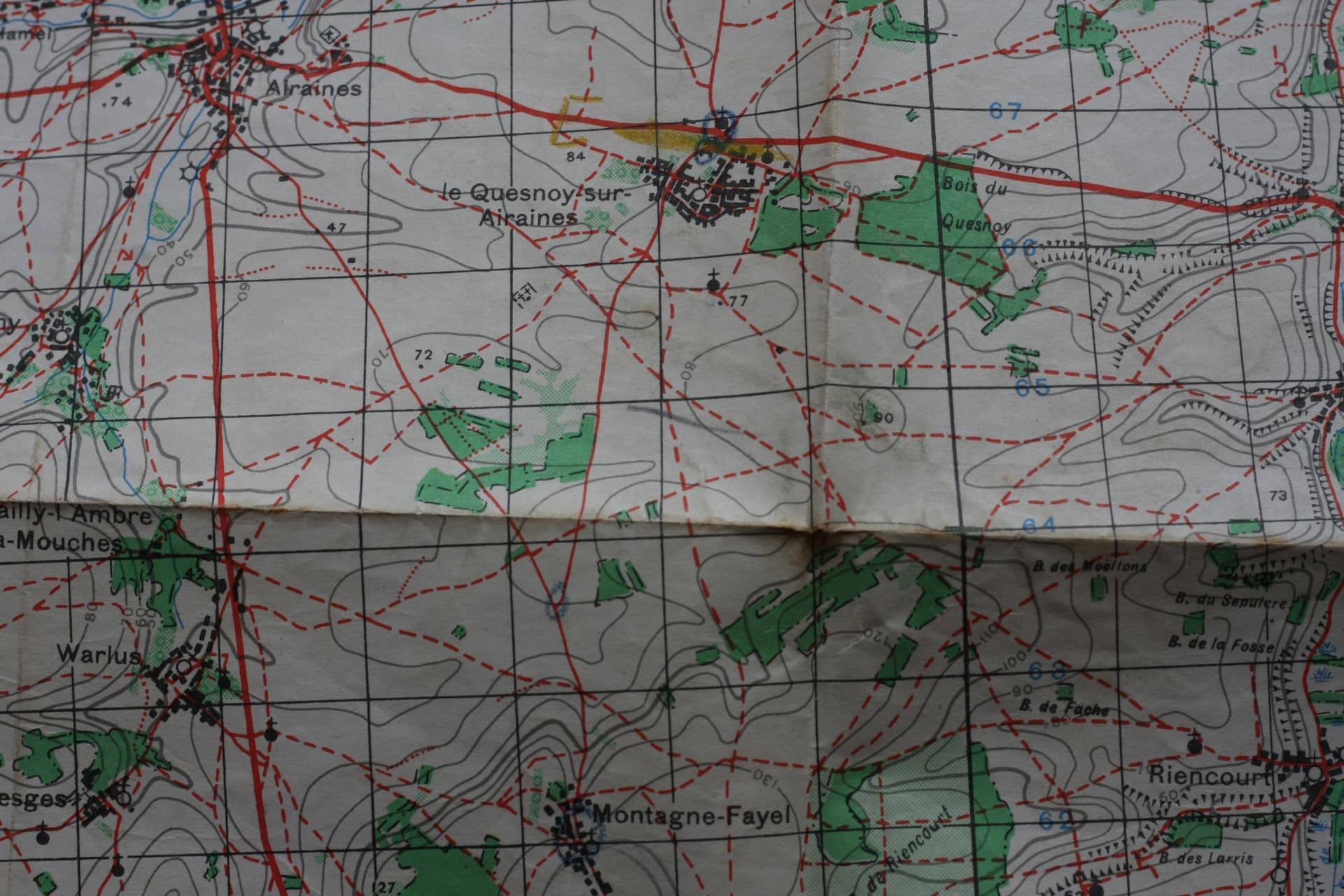
Travels north from le Quesnoy to blue circle just above the number 72.
From the blue circle above the number 72 there are no more blue circles, or lines indicating they arrived at the location marked with the yellow line, or left the map.
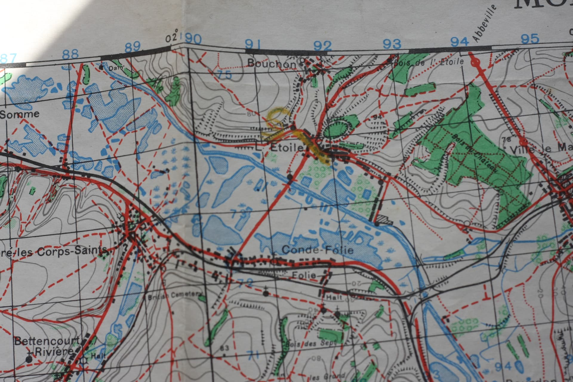
I suspect the map was used to deliver equipment, men, food to the locations marked in yellow.
What I don’t know is.
Where the blue circles drawn on the map to instruct a driver which route to take. Or, where the blue circles drawn by a driver indicating the route taken.

Love that they’re spelt sea, see. ![]()
That came up as a point in the first series of Clarkson’s Farm.
A couple of years ago I ended up doing an impromptu inspection of some sheep with a farmer up on the Ridgeway near West Ilsley in Oxfordshire. We got talking, he had a spare seat in his ATV the border collies weren’t using and so off we went.
We were both in that same demographic and got on like a house on fire but what came over is that it can be a very lonely occupation. It also turned out that he’s a friend of some other farmers I know and we use the same family firm of Land Rover specialists.