Off to the Midlands Air Festival on Sunday.
Not your usual kind of show and a nice and varied line up…
Off to the Midlands Air Festival on Sunday.
Not your usual kind of show and a nice and varied line up…
Ragley ?
The map shows a track leading to some buildings, and from the buildings to the river nearby, which has changed course since then, so it’s not inconceivable that this was used to transport something from the river - maybe salmon, gravel, or even water.
Yep
The river isn’t large enough to support gravel extraction on any sort of scale, certainly not enough to justify a rail connection.
Likewise there wouldn’t be sufficient salmon to justify any permanent infrastructure.
The Tullaghobegley, though small, is a productive salmon and sea trout fishery recording around 300 salmon per season.
There’s water at Falcarragh station less than 3km away so wouldn’t see any need to drag it up from the river at this point.
There is still some turf harvesting nearby, some folks having legacy rights to cut it for their own use. Here’s Zhukov investigating it.
Not aware of there having been anything on a scale that would justify the investment in rail infrastructure. Also any “siding” at this point would be too short to be viable for commercial turf extraction.
Still a bloody mystery. The book I’ve ordered (now out of print) runs to over three hundred pages so hopefully will contains some clue as to what was happening here.
Willy.
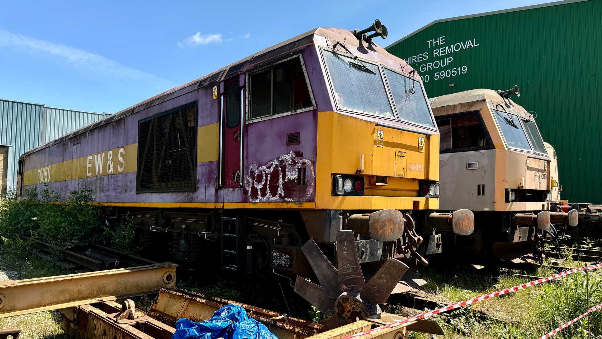
Nice, but needs a little spit and polish … ![]()
Interesting! Are you allowed to say where? (Googling Shires Removals only hinted. ![]() )
)
steve
I see there are suggestions the line used peat as fuel at one stage, and noting the turfing nearby (peat?), I wonder if it was a refuelling stop?
Hi Steve, while the site is normally closed to the general public, if you give them a ring on the number in the 2nd photo, a visit could be arranged, it’s next door to Hemsworth water park at Kinsley.
Yesterday was an open day celebrating the company and owner’s 50th anniversary with lots of other interesting things on display.
Thanks! And noted. ![]()
steve
That sounds like a possibility, or that it was simply a point at which carts loaded with peat were added to a train to be distributed for sale.
In the words of Toyah ‘It’s a mystery’ and Wiki suggests the line was equally for agricultural and foodstuffs (as you suggest) – it could have been an old water tower, given the circular base, but why across the line with a track – idea dismissed! Would help to know what was there before the evergreen wood was planted – I wonder of evergreens chosen as they like moist environments?
I think she sang about a "Mistewee’